


Have you have been collecting GNSS data in Mississippi only to find out that several base stations in the Trimble Pathfinder Office Differential Correction (DC) wizard don’t seem to work properly when you try to post process your data?
Does this message look familiar? …“Unable to extract base data from….”
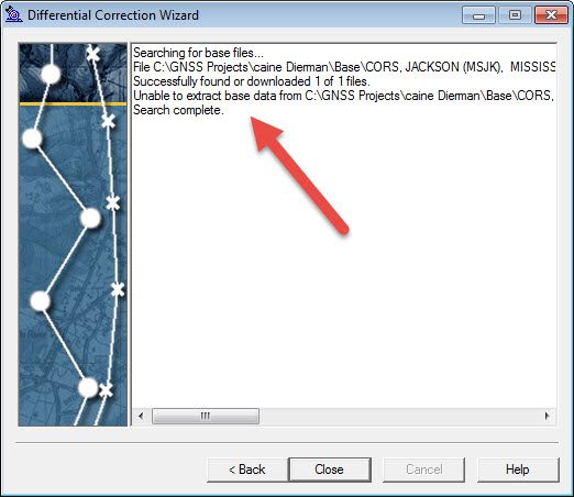
There are several issues that can cause the “unable to extract base data” message in the Pathfinder Office DC Wizard. However, the main reason that we are seeing this message in Mississippi is that several of these CORS sites have been decommissioned.
Below is a map of the current NGS CORS stations in Mississippi. Click on the image to enlarge or check out the interactive map at http://www.ngs.noaa.gov/CORS_Map/

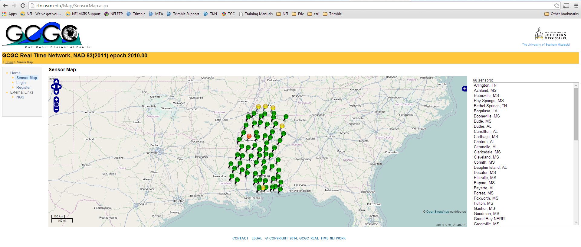
As you can see, there is a huge gap of base stations Mississippi. So, if you are trying to collect High Accuracy GIS data and have to post process this data with base stations that are further away, then your data may result in lower accuracies…especially if you are using Centimeter level equipment. Luckily, the GulfCoast GeoSpatial Center (GCGC) has a network of base stations located through out the state of Mississippi, and the base station data is available for the public to download for free. Below is a map of the GCGC Real-time Network. Click to enlarge.
I have created a video that goes over the steps needed to manually download this base station data so it can be used in the Trimble Pathfinder Office software Differential Correction wizard utility. You will need to create a login (It’s FREE!) in order to view our videos.
How to Differentially Correct Data in MS using Base Stations from GCGC
Let us know if you have any questions. ericb