


Answer
HOW TO USE THE GNSS ONLINE PLANNING TOOL
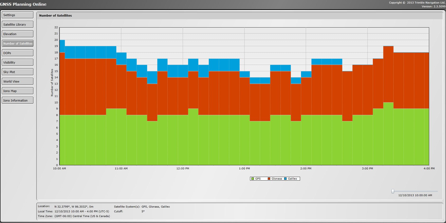
Click on image to enlage
- BROWSE to GNSS Planning Tool
- SETTINGS
- Type in Latitude & Longitude or pick a city
- Antenna height
- Elevation masks
- Date and Time
- If necessary, click on Obstructions and draw in some obstructions (for example trees or buildings that may block the horizon. However, make sure to clear these obstructions before running this tool on another day or for another location.
- Apply these settings
- SATELLITE LIBRARY
- Turn on/off your necessary satellite constellations
- Make sure you only select satellites that your GPS receiver can track. For example a GeoExplrorer 2008 will only track GPS, while a GeoExplorer 6000 with Floodlight will track GPS+Glonass, and a Ge07X has the abiltiy to track GPS+Glonass+Galileo+BeiDou+QZSS. You dont want have constellations that you cant track turned on as it will give you incorrect results.
- NUMBER OF SATELLITES and DOPS
- Both of theses tabs are great places to see when the best times of the day it will be to collect data, but feel free to look around at all the tabs to see what the software has to offer and does.