


Answer
1 October 2013
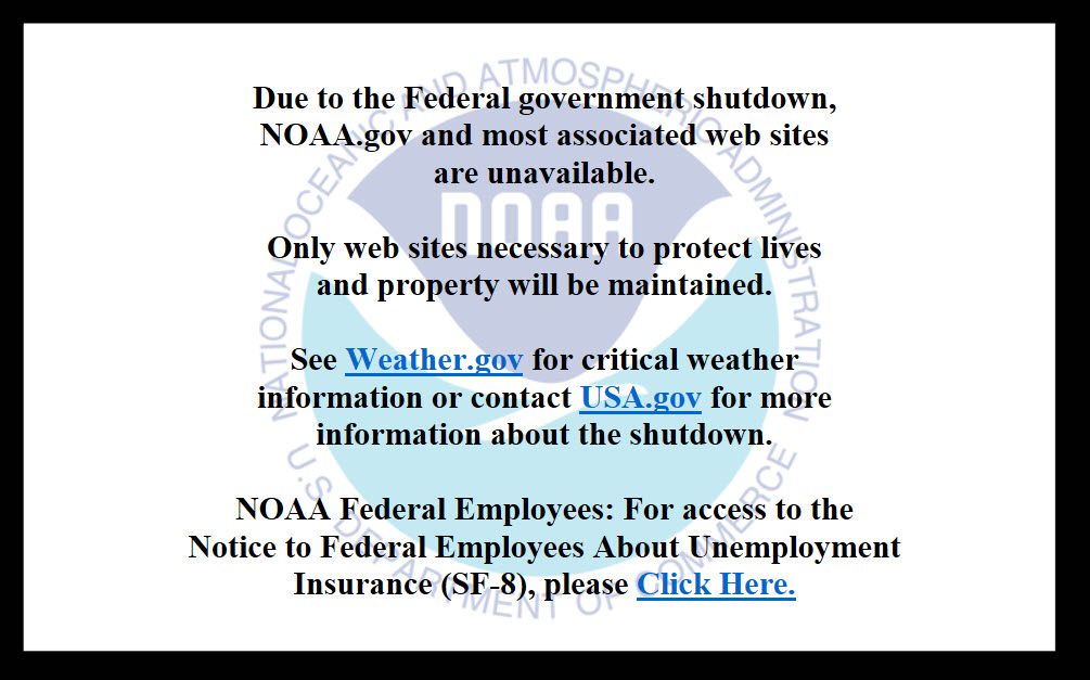
The U.S. Government is shuting down as of today 1 October. The NGS website and associated services, OPUS, UFCORS, CORS ftp servers, etc. will be unavailable. http://governmentshutdown.noaa.gov/
This will affect all users of GPS equipment that rely on NOAA/NGS/CORS base station data for Differential Correction/Post Processing.
Below are some of our recommendations for you to use during this time in order to keep your field crews working:
1) OPUS Alternatives (Survey Workflows only):
- Trimble Centerpoint RTK Post Processing
- Service is free but you need to register
- Check out Seven Free Alternative to OPUS GPS Post-Processing During US Federal Government Shutdown written by Eric Gakstatter from GPS World
- Process the data manually in Trimble Business Center (TBC) or Trimble Geomatics Office (TGO) *Note, see step 2 & 3
2) Try using a base station other than one from the CORS NGS/NOAA webpage (Survey & Mapping workflows)
- You may be able to contact the base station operator directly to see if they will grant you access to the data files.
- Examples
- Arkansas: PAGIS
- Georgia Area: UNAVCO, Rosman NC, GLPS&Geo-Jobe GIS Consulting, Geo-Jobe GIS Consulting, Mt Juliet, City of Franklin, Lexington Base Station
- Texas: TxDOT stations
3) Find out if you can download CORS base station data directly from the source (Survey & Mapping workflows).
- Trimble GPS Pathfinder Office, GPS Analyst or Positions users can manually add a base station if needed.
- Click here for instructions.
- Alabama: The ALDOT web page has options to download static data.
You will need to re-register if you have not done so within the past 4 months. If you are not sure about the status of your registration, let John Russell, russellj@dot.state.al.us, know and he can check it. ALDOT have been putting off moving over to this new system but due to the circumstances it appears now is the time. Part of this process involves setting up a new email contact list. ALDOT currently have two email lists and we need to get this moved over to make it easier sending out notices.
If you have not re-registered within the past 4 months, and wish to continue to receive update emails and access the CORS web page, please re-register now at the following address – http://205.172.52.26/sbc There will be a register option on this login screen you can follow to set up your new account. When setting up your user name and password, keep in mind that eventually it will be used on your rover to access the network or VRS solution. ALDOT will follow up with another email describing it later.
Once your account has been set up, you will have access to the Rinex Job Service. This is a web page that will allow you to create custom Rinex files for download (to post process) similar to the NGS User Friendly CORS page. The main differences are that you will also be able to download data from the non-NGS National CORS sites, and you can request one second data for longer periods. There is a Rinex download guide option on the main web page that will walk you through this process if you have any problems.
There is also a computation service – which is similar to OPUS. It is currently not working but we are looking into it today.
- Florida- FLDOTD requires you to setup an account.
- Georgia – Requires a subscription to EGPS
C4G and the services it provides remain online and because the C4G is the original source for nearly all CORS data here in Louisiana and we know how much the positioning community relies on this data, C4G has setup an anonymous FTP server with access to raw GNSS data from most of the Louisiana National CORS sites. This service is offered to the public free of charge by C4G and will remain in place as long as NGS is unable to make CORS data available.
The C4G anonymous FTP server is available 24/7 @ ftp://cors.lsu.edu:8021/ or in your FTP client at the following settings.
Host: cors.lsu.edu
Port: 8021
Login Type: Anonymous
- Mississipi: Gulf Coast Geospatial Center (GCGC) has options to download static data.
– Browse to the GCGC webpage and create an Account if you dont have one.
– Go to the Reference Data Shop Tab and select Start your order.
– Choose CORS or VRS.
– Pick a station and click on Next
– Enter your Date, Time, and Duration and submit your order
4) Collect data using Real-time (Survey & Mapping workflows)
- Integrated SBAS offers 1-5 meter corrections depending on the GPS device
- Coast Guard Beacon corrections offer submeter accuracy. Only certain Trimble MGIS GPS units have the ability to track these corrections (ProXR, ProXRS, BOB, and GeoBeacon)
- OmniStar corrections are a paid service available on certain Trimble MGIS devices (ProXRS, ProXRT)
- Single Base Corrections
– You can either use your own base station or some companies/state departments offer this as a free service
- VRS corrections (RTK, Decimeter, Submeter accuracies)
– Alabama: ALDOTD operates a free real-time network
– Florida: FLDOTD operates a free real-time network
– Georgia: EGPS operates a paid real-time network
– Louisiana: Gulfnet operates a paid real-time network
– Mississippi: GCGC operates a free real-time network
– Trimble VRSnow: Trimble operates a paid real-time network in MS, AL, FL, etc
4) Contact NEI or your local salesperson if you need more information